

Explore Toronto
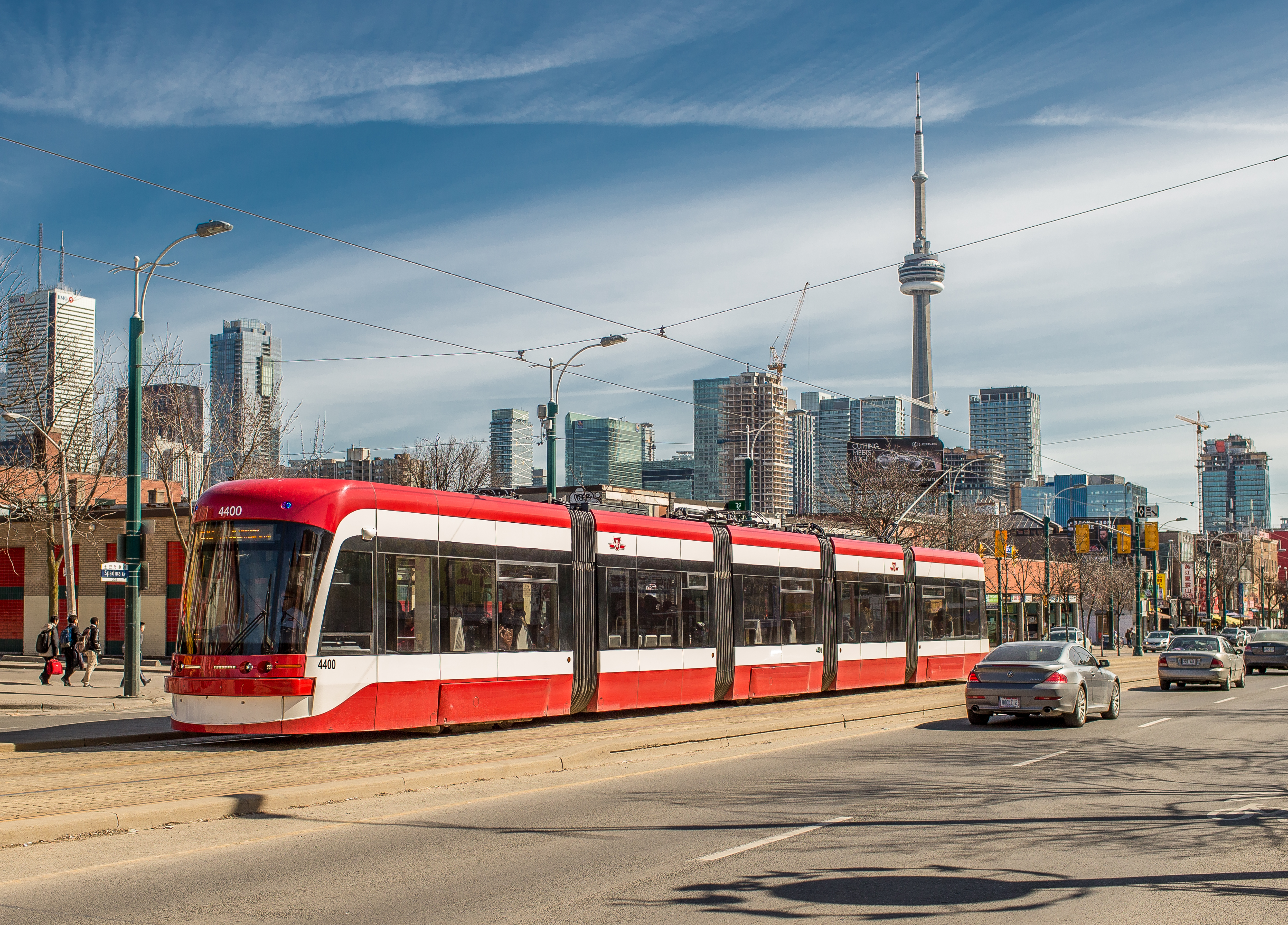
Check out what’s happening in the city this long weekend.
Friday, October 9 – Monday, October 12
See what’s going on in the city this long weekend and how the TTC can take you there. A reminder that seasonal routes continue to operate on weekends, making it easy to get to the Toronto Zoo, Bluffer’s Park, Cherry Beach and High Park.
Please note:The TTC will operate on a holiday schedule on Monday, October 12 for Thanksgiving, and the Customer Service Centre will be closed. Regular hours will resume on Tuesday, October 13.
We encourage customers to check the Service Changes page before travelling, as several events across the city may impact their trip this weekend. For real-time service information, click the Live Service Alerts banner at the bottom of all TTC webpages.
-
Planned weekend closures and service changes
Line 2 (Bloor-Danforth) early closure and full weekend closure – Kipling to Jane stations, Friday, October 9 to Sunday, October 11
Subway service on Line 2 between Kipling and Jane stations will be replaced by shuttle buses on Friday, October 9 at 11:59 p.m. until the end of service on Sunday, October 11 due to planned track work.
Line 2 (Bloor-Danforth) late opening – St George to Broadview stations, Monday, October 12
Subway service on Line 2 between St George and Broadview stations will be replaced by shuttle buses until 11 a.m. on Monday, October 12 due to planned infrastructure maintenance.
-
Sports
Soccer games at BMO Field – Saturday, October 10 and Monday, October 12
170 Princes’ Boulevard
-
Toronto FC vs. CF Montréal – Saturday, October 10, 1 p.m.
-
Canada WNT (Women’s National Team) vs. Denmark – Monday, October 12, 3:30 p.m.
Here are two ways the TTC can take you there:
-
Option 1: Take Line 1 to Union Station, then take the 509 Harbourfront streetcar to Exhibition Loop.
-
Option 2: Take Line 2 to Bathurst Station, then take the 511 Bathurst streetcar to Exhibition Loop.
-
-
Music
BRAND NEW – Friday, October 9, 8 p.m.
Coca-Cola Coliseum, 19 Nunavut Road
Here are several ways the TTC can take you there:
-
Option 1: Take Line 1 to Union Station, then take the 509 Harbourfront streetcar to Exhibition Loop and follow the signs to the venue.
-
Option 2: Take Line 2 to Bathurst Station, then take the 511 Bathurst streetcar to Exhibition Loop and follow the signs to the venue.
-
Option 3: Take Line 2 to Dufferin Station, then take the 29A Dufferin or 929 Dufferin Express bus southbound to Dufferin Gate Loop and follow the signs to the venue.
-
-
Arts and culture
The Stop’s Farmers’ Market – Saturdays, 8 a.m. to 1 p.m.
Wychwood Barns Park, 601 Christie Street
To get there, take Line 1 to St Clair West Station, then take the 512 St Clair streetcar westbound to St Clair Avenue West at Christie Street West Side and head south on Christie Street.
Saturday Farmers Market at Evergreen Brick Works – Saturdays, 8 a.m. to 1 pm.
550 Bayview Avenue
To get there, take Line 1 to Davisville Station, then take the 28 Bayview South bus to Evergreen Brick Works.
Junction Farmers Market – Saturdays, 9 a.m. to 1 p.m.
Baird Park, 275 Keele Street
To get there, take Line 2 to Keele Station and head north on Keele Street.
Withrow Park Farmers’ Market – Saturdays, 9 a.m. to 1 p.m.
Withrow Park, 725 Logan Avenue
To get there, take Line 2 to Chester Station, then head east on Danforth Avenue and south on Logan Avenue towards the park.
Humber Bay Shores Farmers’ Market – Saturdays, 9 a.m. to 2 p.m.
Humber Bay Park West, 2225 Lake Shore Boulevard West
To get there, take Line 2 to Old Mill Station, then take the 66B Prince Edward bus to Marine Parade Drive Loop at Lake Shore Boulevard West and head south.
Allan Gardens Saturday Farmers’ Market – Saturdays, 10 a.m. to 2 p.m.
19 Horticultural Avenue
To get there, take Line 1 to College Station and head east on Carlton Street.
Eglinton Way BIA Farmers’ Market – Sundays, 8 a.m. to 1 p.m.
125 Burnaby Boulevard
To get there, take Line 5 to Avenue Station, then head north on Avenue Road and west on Burnaby Boulevard.
The Leslieville Farmers’ Market – Sundays, 9 a.m. to 2 p.m.
Greenwood Park, 150 Greenwood Avenue
To get there, take Line 2 to Greenwood Station, then take the 31 Greenwood bus to Greenwood Avenue at Athletic Avenue and head south. -
Farmers' markets
The Stop’s Farmers’ Market – Saturdays, 8 a.m. to 1 p.m.
Wychwood Barns Park, 601 Christie Street
To get there, take Line 1 to St Clair West Station, then take the 512 St Clair streetcar westbound to St Clair Avenue West at Christie Street West Side and head south on Christie Street.
Saturday Farmers Market at Evergreen Brick Works – Saturdays, 8 a.m. to 1 p.m.
550 Bayview Avenue
To get there, take Line 1 to Davisville Station, then take the 28 Bayview South bus to Evergreen Brick Works.
Junction Farmers Market – Saturdays, 9 a.m. to 1 p.m.
Baird Park, 275 Keele Street
To get there, take Line 2 to Keele Station and head north on Keele Street.
Withrow Park Farmers’ Market – Saturdays, 9 a.m. to 1 p.m.
Withrow Park, 725 Logan Avenue
To get there, take Line 2 to Chester Station, then head east on Danforth Avenue and south on Logan Avenue to the park.
Humber Bay Shores Farmers’ Market – Saturdays, 9 a.m. to 2 p.m.
Humber Bay Park West, 2225 Lake Shore Boulevard West
To get there, take Line 2 to Old Mill Station, then take the 66B Prince Edward bus to Marine Parade Drive Loop at Lake Shore Boulevard West and head south.
Allan Gardens Saturday Farmers’ Market – Saturdays, 10 a.m. to 2 p.m.
19 Horticultural Avenue
To get there, take Line 1 to College Station and head east on Carlton Street.
Eglinton Way BIA Farmers’ Market – Sundays, 8 a.m. to 1 p.m.
125 Burnaby Boulevard
To get there, take Line 5 to Avenue Station, then head north on Avenue Road and west on Burnaby Boulevard.
The Leslieville Farmers’ Market – Sundays, 9 a.m. to 2 p.m.
Greenwood Park, 150 Greenwood Avenue
To get there, take Line 2 to Greenwood Station, then take the 31 Greenwood bus to Greenwood Avenue at Athletic Avenue and head south.
-
Important notes before you go
The Transit app offers access to new trip-planning features to help customers navigate the TTC’s extensive network of bus, streetcar, subway and light rail transit (LRT) routes. Download Transit for free from the Apple App or Google Play stores.
Visit ttc.ca to use the online Trip Planner and to access Live Service Alerts for real-time updates.
Unexpected delays and diversions can occur at any time. Follow @TTCNotices on X, subscribe to MyTTC e-Services, and check Live Service Alerts on ttc.ca for the most up-to-date information.
For more details on closures, diversions and construction that may impact your commute, please visit:
TTC Customer Service is available daily from 7 a.m. to 10 p.m. (except statutory holidays) at 416-393-3030 and on X at @TTCHelps.
Get out and explore Toronto
Take the TTC to sporting events, top attractions, live music, museums and more – without worrying about traffic or parking.
-
BMO Field
170 Princes’ Boulevard, Toronto
Home of the Toronto Argonauts and Toronto FC.BMO Field is one of Toronto’s primary outdoor stadiums, offering amazing game-day energy and views of Lake Ontario.
Directions:
- Option 1: Take Line 1 to Union Station, then take the 509 Harbourfront streetcar to Exhibition Loop.
- Option 2: Take Line 2 to Bathurst Station, then take the 511 Bathurst streetcar to Exhibition Loop.
Coca-Cola Coliseum at Exhibition Place
19 Nunavut Road, Toronto
Home of the Toronto Tempo, Toronto Marlies and Toronto Sceptres.Coca-Cola Coliseum is a dynamic Toronto venue in the city’s west end which hosts a wide range of live events, from basketball and hockey games to concerts.
Directions:
- Option 1: Take Line 1 to Union Station, then take the 509 Harbourfront streetcar eastbound to Exhibition Loop.
- Option 2: Take Line 2 to Bathurst Station, then take the 511 Bathurst streetcar southbound to Exhibition Loop.
Lamport Stadium
1155 King Street West, Toronto
Lamport Stadium is a multi-purpose outdoor stadium located in Toronto’s Liberty Village neighbourhood. Used for a range of field sports and community activities, the stadium is a well-known venue with a long history in Toronto’s sports landscape.
Directions: Take Line 2 to Dufferin Station, then take the 29A Dufferin or 929 Dufferin Express bus southbound to King Street West and head south.
Rogers Centre
1 Blue Jays Way, Toronto
Home of the Toronto Blue Jays.The Rogers Centre is a versatile venue located in the heart of downtown Toronto that hosts everything from Major League Baseball games to concerts and features a retractable roof and sightlines of the CN Tower.
Directions: Take Line 1 to Union Station, then head west on Front Street or exit to Union Station and follow the SkyWalk.
Scotiabank Arena
40 Bay Street, Toronto
Home of the Toronto Raptors and Toronto Maple Leafs.Scotiabank Arena is a multi-purpose venue in the heart of downtown Toronto that hosts a range of events from basketball and hockey games to concerts.
Directions:
- Option 1: Take Line 1 to Union Station and follow the signs to the Scotiabank Arena.
- Option 2: If you are travelling by bus or streetcar in the downtown core, the 510 Spadina, 19 Bay, 97 Yonge, 114 Queens Quay East and 121 Esplanade-River routes will get you to Union Station. From Union Station, Scotiabank Arena is a short distance south on Bay Street.
Sobeys Stadium
1 Shoreham Drive, Toronto
Venue for the National Bank Open.Sobeys Stadium is an outdoor sport and entertainment venue located on the York University Keele campus in north Toronto. This venue hosts a range of cultural, corporate, and community experiences year-round, including one of the world's largest professional tennis tournaments.
Directions: Take Line 1 to Pioneer Village Station, then head southwest on Ian MacDonald Boulevard.
York Lions Stadium
230 Ian MacDonald Boulevard, Toronto
Home of AFC Toronto.York Lions Stadium is an outdoor sports venue located on York University’s Keele Campus. Originally built as a legacy venue for the 2015 Pan Am and Parapan Am Games, the stadium is now used for football, soccer, and other athletic events.
Directions: Take Line 1 to Pioneer Village Station, then head southeast to the stadium.
-

Concert Venues
Coca-Cola Coliseum at Exhibition Place
19 Nunavut Road, Toronto
Coca-Cola Coliseum is a dynamic Toronto venue that hosts a wide range of live events, from sports games to concerts.
Directions:
- Option 1: Take Line 1 to Union Station, then take the 509 Harbourfront streetcar eastbound to Exhibition Loop.
- Option 2: Take Line 2 to Bathurst Station, then take the 511 Bathurst streetcar southbound to Exhibition Loop.
Danforth Music Hall
147 Danforth Avenue, Toronto
The Danforth Music Hall is a popular concert venue located in Toronto’s east end. Known for its busy live music calendar, the venue hosts a wide variety of artists and performances in one of the city’s most vibrant neighbourhoods.
Directions: Take Line 2 to Broadview Station, then head east on Danforth Avenue.
HISTORY
1663 Queen Street East, Toronto
HISTORY is a modern live music venue in Toronto’s east end. Known for its intimate feel and strong concert lineup, this venue hosts a mix of established artists, emerging performers, and special events.
Directions: Take Line 2 to Coxwell Station, then take the 22B Coxwell bus to Queen Street East at Kingston Road.
Koerner Hall
273 Bloor Street West, Toronto
Koerner Hall is a 1,135-seat concert venue located at The Royal Conservatory of Music. Known for its acoustics and intimate design, the hall hosts classical, jazz, pop, opera, and world music performances.
Directions: Take Line 2 to St George Station, then head east on Bloor Street West.
Massey Hall
178 Victoria Street, Toronto
Massey Hall is a historic concert hall in downtown Toronto. Known for its rich musical legacy since opening in 1894. Following a major restoration in 2021, Massey Hall remains a National Historic Site and continues to host generations of performers across a variety of genres.
Directions: Take Line 1 to Queen Station. Head north on Yonge Street to Shuter Street, then east on Shuter Street.
Meridian Arts Centre
5040 Yonge Street, Toronto
The Meridian Arts Centre is a performing arts venue in the city’s north end that hosts a diverse lineup of theatre, music, dance, and live entertainment.
Directions: Take Line 1 to North York Centre Station, then head south on Yonge Street.
Meridian Hall
1 Front Street East, Toronto
Meridian Hall is a landmark performing arts venue in downtown Toronto. Opened in 1960, it has long been a cornerstone of the city’s cultural scene, hosting everything from Broadway productions and concerts to dance and comedy.
Directions:
- Option 1: Take Line 1 to Union Station, then head east on Front Street.
- Option 2: Take Line 1 to King Station, then head south on Yonge Street.
Phoenix Concert Theatre
410 Sherbourne Street, Toronto
The Phoenix Concert Theatre is a long-standing live music venue located on Sherbourne Street. Celebrating live music in Toronto since 1991, the venue hosts artists across a wide range of genres and continues to be a familiar stop on the city’s concert circuit.
Directions: Take Line 2 to Sherbourne Station, then take the 75 Sherbourne bus to the 418 Sherbourne Street stop and head south.
RBC Amphitheatre
909 Lake Shore Boulevard West, Toronto
RBC Amphitheatre is an outdoor concert venue located on the waterfront at Ontario Place and is known for its open-air setting. This venue hosts artists across genres, offering a mix of covered seating and relaxed lawn experience for concertgoers.
Directions:
- Option 1: Take Line 1 to Union Station, then take the 509 Harbourfront streetcar to Exhibition Loop and head south.
- Option 2: Take Line 2 to Bathurst Station, then take the 511 Bathurst streetcar to Exhibition Loop and head south.
Rebel
11 Polson Street, Toronto
Rebel is a multi-functional concert venue that doubles as a nightclub. Located along Lake Ontario, just east of the downtown core, it has hosted a large range of international artists since opening in 2016.
Directions: Take Line 1 to Union Station, then take the 114 Queens Quay East bus to Commissioners Street at New Cherry Street East Side. Head south on Cherry Street then west on Polson Street.
Rogers Stadium
105 Carl Hall Road, Toronto
Rogers Stadium is a temporary, seasonal open-air concert venue in the north end of Toronto which typically stages shows from May through September. With a lineup of superstar performances and a festival-like atmosphere, it offers fans an immersive live experience with modern amenities and large crowd capacity.
Directions: Take Line 1 to Downsview Park Station. Exit the station and follow the paved path towards Carl Hall Road, then follow directional signage to Rogers Stadium.
Roy Thomson Hall
60 Simcoe Street, Toronto
Roy Thomson Hall is a concert venue located in downtown Toronto. Home to the Toronto Symphony Orchestra, it hosts a wide range of performances, from classical music to contemporary concerts.
Directions: Take Line 1 to St Andrew Station, then head west on King Street.
Scotiabank Arena
40 Bay Street, Toronto
Scotiabank Arena is a multi-purpose venue in the heart of downtown Toronto. Home to the NBA’s Toronto Raptors and the NHL’s Toronto Maple Leafs, this venue hosts a range of events from major sports games to concerts.
Directions:
- Option 1: Take Line 1 to Union Station and follow the signs to the Scotiabank Arena.
- Option 2: If you are travelling by bus or streetcar in the downtown core, the 510 Spadina, 19 Bay, 97 Yonge, 114 Queens Quay East and 121 Esplanade-River routes will get you to Union Station. From Union Station, Scotiabank Arena is a short distance south on Bay Street.
The Concert Hall
888 Yonge Street
The Concert Hall is a historic live event venue located at the Masonic Temple on Yonge Street. With a legacy tied to music, broadcasting, and Toronto’s entertainment history, the venue continues to host concerts and special events in a distinctive heritage setting.
Directions: Take Line 1 or Line 2 to Bloor-Yonge Station, then head north on Yonge Street.
Theatre
Ed Mirvish Theatre
244 Victoria Street, Toronto
The Ed Mirvish Theatre is a central hub for musical and theatrical productions in Toronto. The theatre combines over a century of history with modern renovations, hosting everything from intimate plays to large-scale musicals in its grand two-level auditorium.
Directions: Take Line 1 to TMU Station, then head east on Dundas Street to Victoria Street and south on Victoria Street.
Elgin and Winter Garden Theatres
189 Yonge Street, Toronto
Designated as a National Historic Site, the Elgin and Winter Garden Theatres is a uniquely designed venue which contains two theatres, one stacked on top of the other, and is currently billed as the only operating “stacked” theatre in the world.
Directions: Take Line 1 to Queen Station, then head north on Yonge Street.
Princess of Wales Theatre
300 King Street West, Toronto
The Princess of Wales Theatre is a modern 2,000-capacity theatre in Toronto’s entertainment district. Since opening in 1993, this venue has remained a premier destination for a range of musical and theatrical productions.
Directions: Take Line 1 to St Andrew Station, then head west on King Street.
Queen Elizabeth Theatre
190 Princes’ Boulevard, Toronto
The Queen Elizabeth Theatre is a premier venue located in downtown Toronto. With a capacity of 2,500, this theatre hosts a variety of performers, from musicians to comedians.
Directions: Take Line 1 to Union Station, then take the 509 Harbourfront streetcar to Exhibition Loop. Head southwest on Manitoba Drive to Princes’ Boulevard, then south on Princes' Boulevard.
Royal Alexandra Theatre
260 King Street West, Toronto
The Royal Alexandra Theatre is a National Historic Site known for its architecture and design. Since opening in 1907, the theatre has hosted thousands of productions and welcomed legendary performers from around the world.
Directions: Take Line 1 to St Andrew Station, then head west on King Street.
Museums and Galleries
Art Gallery of Ontario
317 Dundas Street West, Toronto
The Art Gallery of Ontario (AGO) is a popular destination for locals and tourists and houses an exceptional collection of art spanning over centuries and cultures.
Directions: Take Line 1 to St Patrick Station, then head west on Dundas Street.
Aga Khan Museum
77 Wynford Drive, Toronto
Home to more than 1,200 masterpieces spanning over 1,000 years, the Aga Khan Museum is a unique cultural institution that showcases manuscripts, paintings, ceramics and textiles.
Directions:
- Option 1: Take Line 5 to Aga Khan Park & Museum Station. From the station, head north through the park and follow directional signage on the pathway to the museum entrance.
- Option 2: Take Line 2 to Broadview Station or Line 5 to Don Valley Station. Take the 100A Flemingdon Park bus northbound to Wynford Drive at Garamond Court, or head north on Gervais Drive and east on Wynford Drive to the museum.
- Option 3: Take Line 2 to Pape Station, then take the 72 Pape bus to Don Valley Station. Take the 100A Flemingdon Park bus northbound to Wynford Drive at Garamond Court, or head north on Gervais Drive and east on Wynford Drive to the museum.
Bata Shoe Museum
327 Bloor Street West, Toronto
The Bata Shoe Museum is home to over 1,000 shoes and related artifacts. The collection celebrates style, development, and the function of footwear from around the world.
Directions: Take Line 1 or 2 to St George Station, then head west on Bloor Street.
Gardiner Museum
111 Queen's Park, Toronto
The Gardiner Museum is Canada’s national ceramics museum. The museum highlights the role that clay and ceramics play in world history and storytelling.
Directions: Take Line 1 to Museum Station, then head north on Queen's Park.
Metropolitan Toronto Police Museum and Discovery Centre
40 College Street, Toronto
The Toronto Police Museum and Discovery Centre showcases artifacts that are of historic and cultural significance to the Toronto Police Services.
Directions: Take Line 1 to College Station, then head west on College Street.
Museum of Contemporary Art (MOCA)
158 Sterling Road, Toronto
The Museum of Contemporary Art Toronto (MOCA) presents exhibitions, projects, and public programming that connect visitors with contemporary artists and ideas from Toronto and around the world.
Directions: Take Line 2 to Dundas West Station. Head east on Bloor Street to Sterling Road then south.
Power Plant Contemporary Art Gallery
231 Queens Quay West
The Power Plant Contemporary Art Gallery is a leading public gallery located on Toronto’s waterfront. Dedicated to contemporary art, ideas, and conversations, the gallery offers exhibitions and programs with free admission year-round.
Directions: Take Line 1 to Union Station, then take the 509 Harbourfront streetcar to Queens Quay West at Harbourfront and head southwest.
Royal Ontario Museum (The ROM)
100 Queens Park, Toronto
The Royal Ontario Museum is home to art, culture, and nature from across the world. The ROM serves as a national landmark and is a dynamic destination in the heart of Toronto for guests of all ages and backgrounds.
Directions: Take Line 1 or 2 to St George Station, then head east on Bloor Street.
Textile Museum of Canada
55 Centre Avenue, Toronto
The Textile Museum of Canada is home to a collection of more than 15,000 objects from over 200 regions of the world and showcases exhibitions, collections, and programs connected to textile art and culture.
Directions: Take Line 1 to St Patrick Station, then head east on Dundas Street to Centre Avenue.
Toronto Holocaust Museum
4588 Bathurst Street, Toronto
The Toronto Holocaust Museum is a space for education and dialogue about the history of the Holocaust and its ongoing relevance through survivor testimony, exhibits, and immersive learning experiences.
Directions: Take Line 5 to Forest Hill Station, then take the 7 Bathurst bus northbound to the Opposite 4600 Bathurst Street stop.
Attractions and Experiences
Black Creek Pioneer Village
1000 Murray Ross Parkway, Toronto
Black Creek Pioneer Village is a living history museum in north Toronto. With heritage buildings, costumed educators, farm animals, and hands-on activities, the village brings 19th-century Ontario to life for visitors of all ages.
Directions: Take Line 1 to Pioneer Village Station, then take the 108A/108B Driftwood bus westbound to Murray Ross Parkway at Steeles Ave West. Head west on Mill Road to Maple Avenue, then south on Maple Avenue.
Canada’s Wonderland
1 Canada's Wonderland Drive, Vaughan
Canada’s Wonderland is one of the Toronto area’s most popular amusement parks. Located in Vaughan, the park features thrilling roller coasters, family rides, live entertainment and Splash Works water park.
Directions: Take Line 1 to Vaughan Metropolitan Centre Station, then transfer to a 320 or 020 York Region Transit bus for free through Ontario’s One Fare Program.
CN Tower
290 Bremner Boulevard, Toronto
The CN Tower is one of Toronto’s most iconic landmarks. Standing 553 metres/1,815.3 feet tall, it offers panoramic city views, dining, a glass floor, and the seasonal EdgeWalk, a thrilling hands-free walk high above the downtown core.
Directions: Take Line 1 to Union Station, then head west on Front Street or exit to Union Station and follow the SkyWalk.
Centre Island / Centreville Amusement Park
Centre Island is a popular summer escape located just a short ferry ride from downtown Toronto. It is home to Centreville Amusement Park, a family-friendly destination with more than 30 rides and attractions surrounded by parkland and waterfront views.
Directions: Take Line 1 to Union Station, then take the 509 Harbourfront streetcar to Queens Quay Station. Head upstairs and across the street to the ferry docks. Please note that a separate fare is required to take the ferry, and hours vary seasonally.
Distillery Historic District
55 Mill Street, Toronto
The Distillery Historic District is a pedestrian-friendly destination east of downtown Toronto. Set within restored Victorian-era industrial buildings, the area is known for its galleries, boutiques, restaurants, cafés, and year-round cultural events. Don't miss the famous Winter Village!
Directions:
- Option 1: Take Line 1 to King Station, then take any 504 King streetcar eastbound to Parliament Street and head south.
- Option 2: Take Line 2 to Castle Frank Station, then take the 65 Parliament bus southbound to King Street and head south.
- Option 3: Take Line 1 to Union Station, then take the 114 Queens Quay East bus to Parliament Street at Lake Shore Boulevard East and head north.
Evergreen Brick Works
550 Bayview Avenue, Toronto
Evergreen Brick Works is a former brick factory transformed into a community hub for nature, culture, and sustainability. Located in Toronto’s ravines, the site features markets, gardens, trails, public art, and year-round programming.
Directions: Take Line 1 to Davisville Station, then take the 28 Bayview South bus to Evergreen Brick Works.
Exhibition Place
100 Princes’ Boulevard, Toronto
Includes the Canadian National Exhibition (CNE, The Ex), Coca-Cola Coliseum and the Enercare Centre.
Exhibition Place is a major entertainment and event destination on Toronto’s waterfront. Spanning 192 acres, the site is home to convention spaces, sports venues, historic buildings, parkland, and of course, the Canadian National Exhibition, also known as The CNE or The Ex.
Directions:
- Option 1: Take Line 1 to Union Station, then take the 509 Harbourfront streetcar to Exhibition Loop.
- Option 2: Take Line 2 to Bathurst Station, then take the 511 Bathurst streetcar to Exhibition Loop.
Great Canadian Toronto
1133 Queen's Plate Drive
Great Canadian Toronto is a casino resort located near Woodbine Racetrack and Toronto Pearson International Airport. The destination features gaming, dining, a hotel, and a 5,000-person theatre, making it a major entertainment venue in the city’s northwest.
Directions: Take Line 6 to Humber College Station, then take the 37 Islington bus to Woodbine Racetrack Loop.
Harbourfront Centre
235 Queens Quay West, Toronto
Includes KidSpark (part of the Ontario Science Centre)
Harbourfront Centre is a waterfront cultural destination in downtown Toronto. The campus offers arts, music, festivals, exhibitions, recreation, and learning experiences, all set against the backdrop of Lake Ontario.
Directions:
- Option 1: Take Line 1 to Union Station, then take any streetcar to Queens Quay West at Harbourfront Centre.
- Option 2: Take Line 2 to Spadina Station, then take the 510 Spadina streetcar to Queens Quay West at Rees Street.
Hockey Hall of Fame
30 Yonge Street, Toronto
The Hockey Hall of Fame is a must-visit destination for hockey fans. Located in downtown Toronto, it celebrates the history of the sport through exhibits, interactive experiences, hockey artifacts, and the iconic Stanley Cup.
Directions: Take Line 1 to Union Station, then follow directional signage to Brookfield Place exit for direct access.
MaRS Discovery District
101 College Street, Toronto
MaRS Discovery District is a leading innovation hub in downtown Toronto. Located in the city’s Discovery District, MaRS brings together startups, researchers, investors, and industry partners to support science and technology innovation.
Directions: Take Line 1 to Queens Park Station and head east on College Street.
Metro Toronto Convention Centre
255 Front Street West (North Building) and 222 Bremner Boulevard (South Building), Toronto
The Metro Toronto Convention Centre is a leading event and trade show venue in the heart of downtown Toronto. Known for its central location and flexible spaces, it hosts conferences, exhibitions, corporate events, and large-scale gatherings like FAN EXPO.
Directions: Take Line 1 to Union Station, then head west on Front Street or exit to Union Train Station follow directional signage to the SkyWalk indoor path.
Ripley’s Aquarium
288 Bremner Boulevard, Toronto
Ripley’s Aquarium of Canada is an immersive aquatic attraction located beside the CN Tower. With thousands of marine animals, interactive exhibits, and an underwater viewing tunnel, it offers a memorable experience for visitors of all ages.
Directions: Take Line 1 to Union Station, then head west on Front Street or exit to Union Train Station and follow the SkyWalk.
St. Lawrence Market
92–95 Front Street East, Toronto
St. Lawrence Market is one of Toronto’s most beloved food destinations. Located in the historic Old Town neighbourhood, the market is home to specialty food vendors, local merchants, farmers’ markets, and community events.
Directions: Take Line 1 to King Station, then head south on Yonge and east on Front Street East.
Toronto Eaton Centre
220 Yonge Street, Toronto
The Toronto Eaton Centre is a landmark shopping destination in the heart of downtown Toronto. With hundreds of stores, restaurants, and services, it is a major gathering place for locals, commuters, and visitors alike.
Directions: Take Line 1 to TMU Station or Queen Station.
Toronto Zoo
2000 Meadowvale Road, Toronto
The Toronto Zoo is Canada’s largest zoo and a major destination for wildlife education and conservation. Located in the city’s east end, it is home to thousands of animals from around the world, with walking trails, exhibits, and family-friendly experiences.
Directions:
- Option 1: Take Line 2 or Line 5 to Kennedy Station, then take the 86A Scarborough bus to Toronto Zoo.
- Option 2 (seasonal from May to October): From Rouge Hill GO Station Loop, take the 200 Toronto Zoo bus.
Woodbine Racetrack
555 Rexdale Boulevard, Toronto
Woodbine Racetrack is a horse racing and entertainment venue in northwest Toronto known for thoroughbred racing, dining, and special events, plus free admission on race days.
Directions: Take Line 6 to Humber College Station, then take the 37 Islington bus to Woodbine Racetrack Loop.
Yorkdale Shopping Centre
3401 Dufferin Street, Toronto
Yorkdale Shopping Centre is one of Toronto’s premier retail destinations. Located in north Toronto, it features a large mix of luxury brands, popular retailers, and restaurants.
Directions: Take Line 1 to Yorkdale Station.
-
For more Toronto civic and historic sites, visit the City of Toronto website.
Allan Gardens Conservatory
19 Horticultural Avenue, Toronto
Allan Gardens Conservatory is a historic indoor botanical garden in downtown Toronto. Featuring five greenhouses with tropical plants, palms, orchids, bromeliads, cacti, and seasonal flower displays, it offers visitors a year-round garden experience in the heart of the city.
Directions: Take Line 2 to Sherbourne Station, then take the 75 Sherbourne bus south to Gerrard Street East.
Campbell House
160 Queen Street West, Toronto
Campbell House Museum is a historic house museum located at Queen Street West and University Avenue. Built in 1822, the house is one of Toronto’s landmark historic spaces and offers guided tours, exhibits, and cultural programming in a restored Georgian-style setting.
Directions: Take Line 1 to Osgoode Station, then head west on Queen Street.
Casa Loma
1 Austin Terrace, Toronto
Casa Loma is a historic castle and museum in midtown Toronto. Known for its grand architecture, decorated rooms, towers, tunnels, and gardens, it offers visitors a glimpse into Toronto’s early 20th-century history.
Directions:
- Option 1: Take Line 1 to Dupont Station, then head north on Spadina Road.
- Option 2: Take Line 1 or 2 to Spadina Station, then take the 127 Davenport bus northbound to Spadina Road at Davenport Road and head north.
Colborne Lodge
11 Colborne Lodge Drive
Colborne Lodge is a Regency-era cottage located in High Park. Built in 1837, the historic home shares the story of John and Jemima Howard, whose vision helped create High Park as a lasting public legacy for Torontonians.
Directions:
- Option 1: From Queen or Osgoode stations, take the 501 Queen streetcar westbound to the Queensway at Colborne Lodge Drive West Side and head north.
- Option 2: Take Line 2 to Keele Station, then take the 80 Queensway bus to Lake Shore Boulevard West at Colborne Lodge Drive West Side and head north.
Fort York
250 Fort York Boulevard, Toronto
Fort York National Historic Site is one of Toronto’s most important historic landmarks. The site features original War of 1812 buildings and shares the stories of the people who defended the Town of York, now known as Toronto.
Directions:
- Option 1: Take Line 1 to Union Station, then take the 509 Harbourfront streetcar to Fleet St at Bastion St West Side and head north on Gzowski Boulevard.
- Option 2: Take Line 2 to Bathurst Station, then take the 511 Bathurst streetcar to Bathurst Street at Fort York Boulevard and head west.
Gibson House Museum
5172 Yonge Street, Toronto
Gibson House Museum is a historic farmhouse located in North York. Built in 1851, the museum shares the story of David Gibson and his family while exploring 19th-century rural life, domestic arts, and the growth of North York.
Directions: Take Line 1 to North York Centre Station, then head north on Yonge Street.
Mackenzie House
82 Bond Street
Mackenzie House is a historic downtown house museum and the final home of William Lyon Mackenzie, Toronto’s first mayor. The museum explores Victorian Toronto, early democracy, printing history, and the life of one of the city’s most controversial historic figures.
Directions: Take Line 1 to TMU Station, then head east on Dundas Street East and south on Bond Street.
Montgomery's Inn
4709 Dundas Street West, Toronto
Montgomery’s Inn is a historic inn in Etobicoke dating back to the 1830s. Once a gathering place for travellers, the museum now offers visitors a look at 19th-century inn life through tours, community events, food programs, and local history.
Directions: Take Line 2 to Islington Station, take the 37A/37B Islington or the 937 Islington Express bus to Islington Avenue at Dundas Street West and head northeast on Dundas Street West.
Ontario Legislature
111 Wellesley Street West, Toronto
The Ontario Legislature is the historic home of the Legislative Assembly of Ontario, located at Queen’s Park. Visitors can explore the building’s history, architecture, art, and parliamentary traditions through tours, exhibits, and public programs.
Directions: Take Line 1 to Queens Park Station, then head north on Queen's Park Crescent.
Osgoode Hall
130 Queen Street West, Toronto
Osgoode Hall is a historic legal landmark located on Queen Street West. Home to the Law Society of Ontario, the Court of Appeal for Ontario, and the Superior Court of Justice, the nearly 200-year-old building is known for its architecture, legal heritage, and guided tours.
Directions: Take Line 1 to Osgoode Station, then head east on Queen Street.
Scarborough Historical Museum
1007 Brimley Road, Toronto
Scarborough Museum is a community history museum located in Thomson Memorial Park. Through heritage buildings, gardens, programming, and events, the museum shares stories of Scarborough’s diverse past, present, and future.
Directions: Take Line 2 to Kennedy Station, then take the 21 Brimley bus to Brimley Road at Britwell Avenue and head northeast.
Spadina Museum and Spadina House
285 Spadina Road, Toronto
Spadina Museum is a historic mansion and garden overlooking Toronto. Through the story of the Austin family and those who worked in the home, the museum explores life in Toronto from the early 1900s to the 1930s.
Directions:
- Option 1: Take Line 1 to Dupont Station, then head north on Spadina Road.
- Option 2: Take Line 1 or 2 to Spadina Station, then take the 127 Davenport bus northbound to Spadina Road at Davenport Road and head north.
Todmorden Mills
67 Pottery Road
Todmorden Mills is a heritage site in the Don Valley that preserves part of Toronto’s early industrial history. The site includes historic buildings, a former brewery, the Papermill Theatre and Gallery, and a 9.2-hectare wildflower preserve with walking trails.
Directions: Take Line 2 to Broadview Station. Exit the station to Broadview Avenue at Erindale Avenue, then take the 8 Broadview bus northbound to Broadview Avenue at Mortimer Avenue North Side and head northwest on Pottery Road to Todmorden Mills Road.
Toronto City Hall and Nathan Phillips Square
100 Queen Street West, Toronto
Toronto City Hall and Nathan Phillips Square are central civic landmarks in downtown Toronto. The square is a popular gathering place for public events, seasonal skating, cultural celebrations, and views of the city’s iconic municipal buildings. City Hall was even featured in “Star Trek: The Next Generation”!
Directions:
- Option 1: Take Line 1 to Queen Station, then head west on Queen Street.
- Option 2: Take Line 1 to Osgoode Station, then head east on Queen Street.
Toronto Railway Museum
255 Bremner Boulevard
The Toronto Railway Museum is located at the John Street Roundhouse National Historic Site in downtown Toronto. The museum shares the city’s railway and transit history through exhibits, historic rail equipment, tours, and seasonal activities in Roundhouse Park.
Directions: Take Line 1 to Union Station, then head south on York Street and west on Bremner Boulevard.
Toronto Reference Library
789 Yonge Street, Toronto
The Toronto Reference Library is one of the city’s largest and most recognizable public libraries. Located near Yonge and Bloor streets, it offers extensive collections, study spaces, exhibitions, events, and resources for visitors and researchers.
Directions: Take Line 1 to Bloor-Yonge Station, then head north on Yonge Street.
Toronto's First Post Office
260 Adelaide Street East, Toronto
Toronto’s First Post Office is a museum, National Historic Site, and working post office in the St. Lawrence neighbourhood. Built in 1833, it is Canada’s oldest surviving purpose-built post office still in operation.
Directions: Take Line 1 to King or St Andrew Station, then take the 504 King streetcar eastbound to King Street East at Jarvis Street East Side. Head east on King Street East, north on George Street and east on Adelaide Street East.
-
Ashbridge's Bay Park
1561 Lake Shore Boulevard East, Toronto
Ashbridge’s Bay Park is a waterfront park in Toronto’s east end. Known for its trails, marina, beach access, and lake views, it is a popular spot for walking, cycling, picnics, and seasonal fireworks.
Directions:
- Option 1: Take Line 1 to King Station, then take the 503 Kingston Road streetcar eastbound to Emdaabiimok Avenue and head south on Emdaabiimok Avenue.
- Option 2: Take Line 2 to Woodbine Station, then take the 92 Woodbine bus southbound to Woodbine Beach Loop at Lake Shore Boulevard East and head south.
Biidaasige Park
51 Commissioners Street, Toronto
Biidaasige Park, pronounced “bee-daw-si-geh," is a new waterfront park in Toronto’s Port Lands, located on Ookwemin Minising near Cherry Street. Meaning “sunlight shining toward us” in Anishinaabemowin, the park celebrates waterway restoration and reconciliation, with naturalized landscapes, public gathering spaces, and connections to the restored Don River and Lake Ontario.
Directions: Take Line 1 to Union Station, then take the 114 Queens Quay East bus to Commissioners Street at Munition Street and head east.
Bluffer’s Park and Beach
1 Brimley Road South, Toronto
Bluffer’s Park and Beach is a scenic waterfront destination below the Scarborough Bluffs. With sandy beach areas, trails, picnic spaces, and dramatic cliff views, it offers one of Toronto’s most striking natural landscapes.
Directions:
- Option 1: Take Line 2 to Kennedy Station, then take the 12 Kingston Rd bus southbound to Kingston Road at Brimley Road West Side and head south on Brimley Road South.
- Option 2 (seasonal from early May to early October): Take Line 2 to Kennedy Station, then take the 201 Bluffer’s Park bus southbound to Scarborough Bluffs Beach Loop at Bluffers Park Road.
Centennial Park
256 Centennial Park Road, Toronto
Centennial Park is a large regional park in the city’s west end. The park offers a wide range of recreation options, including sports fields, trails, picnic areas, gardens, and seasonal activities.
Directions:
- Option 1: Take Line 2 to Royal York Station, then take the 48 Rathburn bus westbound to 590 Rathburn Road and head north.
- Option 2: Take Line 2 to Kipling Station, then take the 112 West Mall bus to Renforth Drive at Eglinton Avenue West and head south.
- Option 3: Take Line 5 to Mount Dennis Station, then take the 32 Eglinton West bus to Renforth Station and head south.
Cherry Beach (Clarke Beach Park)
1 Cherry Street, Toronto
Cherry Beach, also known as Clarke Beach Park, is a relaxed waterfront park near Toronto’s Port Lands. Known for its beach, open green space, and lake access, it is a favourite spot for swimming, paddling, walking, and enjoying the outdoors.
Directions:
- Option 1: Take Line 1 to Union Station, then take the 114 Queens Quay East bus to Commissioners Street at Cherry Street East Side. Head south on Cherry Street, east on Unwin Avenue and south on Regatta Road.
- Option 2 (seasonal from early May to early October): Take Line 1 to Union Station, then take the 202 Cherry Street bus to Cherry Street at Unwin Avenue. Head east on Unwin Avenue then south on Regatta Road.
Colonel Samuel Smith Park
3145 Lake Shore Boulevard West
Colonel Samuel Smith Park is a waterfront park in the city’s west end located along Lake Ontario. Known for its shoreline trails, natural habitats, and birdwatching opportunities, the park offers scenic lake views and a peaceful outdoor escape in Toronto’s west end.
Directions: Take Line 2 to Kipling Station, then take the 44 Kipling South bus to Colonel Samuel Smith Park Drive and head south.
Downsview Park
70 Canuck Avenue, Toronto
Downsview Park is a large urban park in north Toronto. The site offers trails, open fields, sports facilities, community programming, and space for festivals, markets, and outdoor events.
Directions: Take Line 1 to Downsview Park Station, then take the 108B Driftwood or the 106 Sentinel bus westbound to Sheppard Avenue West at Keele Street and head southeast.
Earl Bales Park
4169 Bathurst Street, Toronto
Earl Bales Park is a large green space in the city’s north end. With trails, picnic areas, an amphitheatre, playgrounds, and a seasonal ski and snowboard centre, it offers outdoor activities throughout the year.
Directions: Take Line 5 to Forest Hill Station, then take the 7 Bathurst bus northbound to Bathurst Street at Bainbridge Avenue.
Edwards Gardens
755 Lawrence Avenue East
Edwards Gardens is a public garden located near Leslie Street and Lawrence Avenue East. Featuring perennials, roses, wildflowers, rockeries, and bridges over Wilket Creek, the garden is also home to spaces managed by Toronto Botanical Garden.
Directions: Take Line 5 to Laird Station, then take the 51 Leslie bus northbound to Leslie Street at Lawrence Avenue East and head west.
Harbour Square Park
25 Queens Quay West
Harbour Square Park is a waterfront park located near the Jack Layton Ferry Terminal. With a boardwalk, open green space, and views of Toronto Harbour, the park is a popular spot to relax before or after visiting the Toronto Islands.
Directions: Take Line 1 to Union Station, then take the 509 Harbourfront or the 510 Spadina streetcar to Queens Quay/Ferry Docks Station and head south.
High Park
1873 Bloor Street West, Toronto
High Park is one of Toronto’s largest and most popular parks. Known for its trails, gardens, zoo, playgrounds, Grenadier Pond, and spring cherry blossoms, it offers nature, recreation, and community experiences year-round.
Directions:
- Option 1: Take Line 2 to High Park Station, then head southwest to the park.
- Option 2 (seasonal from March to October): Take Line 2 to High Park Station, then take the 203 High Park bus.
HTO Park
339 Queens Quay West
HTO Park is an urban beach and waterfront park located along Toronto’s Inner Harbour. Known for its yellow umbrellas, Muskoka chairs, sandy beach area, and grassy hills, the park offers a relaxed place to enjoy the waterfront and city views.
Directions: Take Line 1 to Union Station, then take the 509 Harbourfront or the 510 Spadina Streetcar to Queens Quay West at Rees Street West Side and head west.
Humber Bay Parks
2225 Lake Shore Boulevard West (west park) and 2195 Lake Shore Boulevard West (east park), Toronto
Humber Bay Parks are scenic waterfront parks in Toronto’s west end. Known for skyline views, trails, birdwatching, and peaceful lakefront spaces, they offer a quiet escape along Lake Ontario.
Directions: Take Line 2 to Old Mill Station, then take the 66B Prince Edward bus to Marine Parade Drive Loop at Lake Shore Boulevard West and head south.
James Gardens
99 Edenbridge Drive
James Gardens is a public botanical garden in Etobicoke along the Humber River. Known for its formal gardens, stone pathways, spring-fed pools, streams, and mature trees, the park offers a quiet setting for walks, nature viewing, and photography.
Directions: Take Line 2 to Royal York Station, then take the 48 Rathburn or the 73B/73C Royal York bus northbound to Royal York Road at Ashley Park Road North Side and head northeast.
Kew Gardens
2075 Queen Street East
Kew Gardens is a large public park in The Beaches neighbourhood, stretching from Queen Street East toward Lake Ontario. The park features walking paths, gardens, recreation facilities, and historic landmarks, and is a central gathering place in the community.
Directions: Take Line 2 to Main Street Station, then take the 64 Main bus to Hambly Avenue at Queen Street East North Side. Head west on Queen Street East and south on Lee Avenue.
Milne Dam Conservation Park
8251 McCowan Road, Markham
Milne Dam Conservation Park is Markham’s largest park, located along the Rouge River and Milne Reservoir. The park offers trails, picnic areas, natural habitats, and birdwatching opportunities in a peaceful conservation setting.
Directions: Take Line 2 to Kennedy Station, then take the 129A McCowan North bus to McCowan Road at Southdale Drive and head south.
Riverdale Farm
201 Winchester Street, Toronto
Riverdale Farm is a family-friendly farm experience in Toronto's Cabbagetown neighbourhood. Visitors can explore barns, gardens, and pathways while seeing farm animals in a peaceful urban setting.
Directions: Take Line 1 to College Station, then take the 506 Carlton streetcar eastbound to Carlton Street at Parliament Street and head east on Carlton Street.
Sunnybrook Park
1132 Leslie Street, Toronto
Sunnybrook Park is a spacious park in midtown Toronto. With trails, sports fields, picnic areas and open green space, it offers a quiet place for walking, cycling, and enjoying nature.
Directions: Take Line 1 to Lawrence Station, then take the 162 Lawrence-Donway bus to Glenorchy Road at Suncrest Drive and head southwest.
Trinity Bellwoods Park
790 Queen Street West, Toronto
Trinity Bellwoods Park is a lively green space in Toronto’s west end. Known for its community feel, open lawns, sports facilities, and gathering spaces, it is a popular destination for picnics, walks, and neighbourhood events.
Directions: Take Line 1 to Osgoode Station, then take the 501 Queen streetcar westbound to Queen Street West at Strachan Avenue.
-
Baycrest
3560 Bathurst Street, Toronto
Directions: Take Line 2 to Bathurst Station or Line 5 to Forest Hill Station, then take the 7 Bathurst bus northbound to Bathurst Street at Baycrest Avenue.
Centre for Addiction and Mental Health
Queen Street Site (including CAMH’s Emergency Department) – 1001 Queen Street West, Toronto
Directions:
- Option 1: Take Line 2 to Ossington Station, then take the 63 Ossington bus southbound to Ossington Avenue at Queen Street West and head west.
- Option 2: Take the 501 Queen streetcar to Queen Street West at Ossington Avenue and head west.
College Street Site – 250 College Street, Toronto
Directions: Take Line 1 or 2 to Spadina Station, then take the 510 Spadina streetcar southbound to the corner of College Street and Spadina Avenue. Head east on College Street to Huron Street, then north on Huron Street to Russell Street.
Hospital for Sick Children (SickKids)
170 Elizabeth Street
Directions:
- Option 1: Take Line 1 to Queen’s Park Station, then head east on College Street and south on Elizabeth Street.
- Option 2: Take Line 1 to St Patrick Station, then head north on University Avenue and east on Elm Street to Elizabeth Street.
Mount Sinai Hospital
600 University Avenue, Toronto
Directions: Take Line 1 to Queen's Park Station, then take the southwest exit and head south on University Avenue.
North York General Hospital
4001 Leslie Street, Toronto
Directions: Take Line 4 to Leslie Station, then head south on Leslie Street.
Princess Margaret Cancer Centre
610 University Avenue, Toronto
Directions: Take Line 1 to Queen's Park Station, then take the southwest exit and head south on University Avenue.
Reactivation Care Centre
Church Site – 200 Church Street, Toronto
Directions: Take Line 1 to Lawrence West Station, then take the 59 Maple Leaf bus to Uphill Avenue at Woodward Avenue.
Finch Site – 555 Finch Avenue West, Toronto
Directions: Take Line 6 to Norfinch Oakdale Station and head southwest.
Rekai Centre at Wellesley Central Place
160 Wellesley Street East, Toronto
Directions: Take Line 2 to Sherbourne Station, then take the 75 Sherbourne bus to Sherbourne Street at Gerrard Street East. Head west on Wellesley Street East and north on Homewood Avenue.
St. Michael's Hospital
30 Bond Street, Toronto
Directions: Take Line 1 to Queen Station, then head east on Queen Street East to Victoria Street.
Scarborough Health Network General Hospital
3050 Lawrence Avenue East, Toronto
Directions: Take Line 2 to Warden Station, then take the 16 McCowan bus to McCowan Road at Lawrence Avenue East.
Scarborough Health Network
General Hospital – 3050 Lawrence Avenue East, Toronto
Directions: Take Line 2 to Warden Station, then take the 16 McCowan bus to McCowan Road at Lawrence Avenue East and head west.
Birchmount Hospital – 3030 Birchmount Road, Toronto
Directions: Take Line 1 to Finch Station, then take the 939A/939B Finch Express or the 39A/39B Finch bus eastbound to Finch Avenue East at Birchmount Road. Head north on Birchmount Road.
Sunnybrook Health Sciences Centre
2075 Bayview Avenue, Toronto
Directions: Take Line 1 to Davisville Station, then take the 11 Bayview bus northbound to Hospital Road at Wellness Way East Side.
Michael Garron Hospital (Toronto East General Hospital)
825 Coxwell Avenue, Toronto
Directions: Take Line 2 to Coxwell Station, then take the 70 O'Connor bus northbound to Coxwell Avenue at Sammon Avenue.
Toronto General Hospital
200 Elizabeth Street, Toronto
Directions: Take Line 1 to Queen's Park Station, then take the southeast exit and head south on University Avenue.
Toronto Grace Health Centre
650 Church Street, Toronto
Directions: Take Line 1 or Line 2 to Bloor-Yonge Station, then head east on Bloor Street East to Church Street and south on Church Street.
Toronto Western Hospital
399 Bathurst Street, Toronto
Directions:
- Option 1: Take Line 2 to Bathurst Station, then take the 511 Bathurst streetcar southbound to Bathurst Street at Dundas Street West.
- Option 2: Take Line 1 to TMU Station or St Patrick Station, then take the 505 Dundas streetcar westbound to Dundas Street West at Bathurst Street.
Women's College Hospital
76 Grenville Street, Toronto
Directions: Take Line 1 to College Station, then take the 506 Carlton streetcar westbound to Elizabeth Street and head north on Elizabeth Street.
-

Billy Bishop Airport
2 Eireann Quay, Toronto
Billy Bishop Toronto City Airport is located on Toronto Island, minutes from downtown. The airport offers convenient access to more than 20 destinations in Canada and the United States, with flights, services, and amenities designed for short-haul travel.
Directions:
- Option 1: Take Line 1 to Union Station, then take the 509 Harbourfront streetcar westbound to Bathurst Street and Queens Quay West. Head south on Bathurst Street to the Billy Bishop Ferry Terminal Building.
- Option 2: Take Line 2 to Bathurst Station, then take the 511 Bathurst streetcar southbound to Bathurst Street and Fleet Street. Head south to Billy Bishop Ferry Terminal Building.
Queen's Quay Terminal
207 Queens Quay West, Toronto
Queen’s Quay Terminal is a historic waterfront building along Toronto’s harbourfront. Originally built as a warehouse, it now offers dining, retail, office, and residential spaces in a unique lakeside setting.
Directions: Take Line 1 to Union Station, then take the 509 Harbourfront streetcar southbound to Queens Quay West and York Street.
Toronto Island Ferry Terminal
Bay Street and Queens Quay, Toronto
The Jack Layton Ferry Terminal is the main gateway to the Toronto Islands. Located at the foot of Bay Street, it offers ferry service to Centre Island, Hanlan’s Point, and Ward’s Island throughout the year.
Directions: Take Line 1 to Union Station, then take any streetcar southbound to Queens Quay/Ferry Docks Station and head south to the ferry docks. Please note that a separate fare is required to take the ferry, and hours vary seasonally.
Toronto Pearson International Airport
6301 Silver Dart Drive, Mississauga
Toronto Pearson International Airport is Canada’s largest and busiest airport. Located northwest of downtown Toronto, it connects travellers to domestic and international destinations, with transit, parking, dining, and passenger services on site.
There are several routes you can take to Toronto Pearson International Airport.
Union Station
65 Front Street West, Toronto
Union Station is Toronto’s central transportation hub and a National Historic Site. Serving GO Transit, VIA Rail, UP Express, and the TTC, it is also a downtown destination for shopping, dining, events and heritage architecture.
Directions: From any Line 1 station, head southbound to Union Station. If you are travelling by bus or streetcar in the downtown core, the 510 Spadina, 19 Bay, 97 Yonge, 114 Queens Quay East and 121 Esplanade-River routes will also get you to Union Station.
-

Centennial College
Centennial College is Ontario’s first public college, with multiple campuses primarily located in the eastern part of the Greater Toronto Area. Centennial offers career-focused programs, hands-on learning, and strong industry partnerships that prepare students for success in the workforce.
Centennial College – Ashtonbee Campus
75 Ashtonbee Road, Toronto
Directions:
- Option 1: Take Line 5 to Golden Mile Station, then head north on Warden Avenue and west on Ashtonbee Road to campus.
- Option 2: Take Line 2 to Warden Station, then take the 968 Warden Express or 68 Warden bus northbound to Warden Avenue at Ashtonbee Road and head west to campus.
Nearby bus routes:
- 68 Warden
- 968 Warden Express
Centennial College – Morningside Campus
755 Morningside Avenue, Toronto
Directions:
- Option 1: Take Line 2 to Kennedy Station, then take the 905 Eglinton East Express, 38 Highland Creek, 116 Morningside or 154 Curran Hall bus to Ellesmere Road at Morningside Avenue and head northeast to campus.
- Option 2: Take Line 1 to York Mills Station, then take the 995 York Mills Express or 95 York Mills bus to Ellesmere Road at Morningside Avenue and head northeast to campus.
Nearby bus routes:
- 12D Kingston Road
- 38A Highland Creek
- 116 Morningside
- 154 Curran Hall
- 905 Eglinton East Express
Centennial College – Progress Campus
941 Progress Avenue, Toronto
Directions:
- Option 1: Take Line 2 to Kennedy Station, then take the 903A Kennedy Station-Scarborough Express bus to the Centennial College Bus Terminal.
- Option 2: Take Line 2 to Warden Station, then take the 902 Markham Road Express or the 102A Markham Road bus to the Centennial College Bus Terminal.
- Option 3: Take Line 1 to York Mills Station, then take the 995 York Mills Express or 95 York Mills bus to Ellesmere Road at Markham Road. Transfer to the 902 Markham Road Express or the 102A Markham Road bus northbound to the Centennial College Bus Terminal.
Nearby bus routes:
- 102A Markham Rd
- 134D Progress
- 902 Markham Rd Express
- 903A Centennial Express
Collège Boréal
60 Distillery Lane, Toronto
Collège Boréal is a French-language post-secondary institution serving communities across Ontario, including a Toronto campus. Through its programs and services, Boréal supports Francophone learners with education, training and community connections.
Directions:
- Option 1: Take Line 1 to King Station, then take any 504 King streetcar eastbound to King Street East at Parliament Street. Head south on Parliament Street and east on Distillery Lane.
- Option 2: Take Line 2 to Castle Frank Station, then take the 65 Parliament bus southbound to Parliament Street at Mill Street and head east on Distillery Lane.
George Brown Polytechnic
George Brown Polytechnic is a downtown Toronto institution with campuses in the heart of the city, including Casa Loma, St. James, and Waterfront. Known for practical, real-world learning, George Brown connects students with industry opportunities and programs that support career success.
George Brown Polytechnic – Casa Loma Campus
160 Kendal Avenue, Toronto
Directions: Take Line 1 to Dupont Station, then head north on Spadina Road to Macpherson Avenue and west to Kendal Avenue.
Nearby bus routes:
- 127 Davenport
George Brown Polytechnic – St. James Campus
200 King Street East, Toronto
Directions:
- Option 1: Take Line 1 to King Station, then head east on King Street East to campus.
- Option 2: Take Line 1 to King Station or St Andrew Station, then take the 504 King streetcar eastbound to King Street East at Jarvis Street East Side and head east to campus.
- Option 3: Take Line 2 to Broadview Station, then take the 504 King streetcar to King Street East at Jarvis Street West Side and head east to campus.
- Option 4: Take Line 2 to Sherbourne Station, then take the 75 Sherbourne bus to Sherbourne Street at King Street East and head west to campus.
Nearby bus and streetcar routes:
- 121 Esplanade-River
- 504 King
George Brown Polytechnic – Waterfront Campus
51 Dockside Drive, Toronto
Directions:
- Option 1: Take Line 1 to Union Station, then take the 114 Queens Quay East bus to Queens Quay East at Dockside Drive and head south to campus.
- Option 2: Take Line 2 to Sherbourne Station, then take the 75 Sherbourne bus to Lower Sherbourne Street at Queens Quay East and head south to campus.
- Option 3: Take Line 2 to Castle Frank Station, then take the 65 Parliament bus to Queens Quay East at Lower Sherbourne Street and head south to campus.
Nearby bus routes:
- 65 Parliament
- 121 Esplanade-River
- 114 Queens Quay East
Humber Polytechnic
Humber Polytechnic is one of Toronto’s leading post-secondary institutions, offering programs across a wide range of career areas. With hands-on learning, industry connections, and flexible pathways, Humber prepares students to thrive in their careers and communities.
Humber Polytechnic – Lakeshore Campus
2 Colonel Samuel Smith Park Drive, Toronto
Directions:
- Option 1: Take Line 2 to Kipling Station, then take the 944 Kipling South Express bus to the Humber College Campus stop.
- Option 2: Take Line 2 to Kipling Station, then take the 44 Kipling South bus to Kipling Avenue at Lake Shore Boulevard West and head southwest to campus.
- Option 3: Take Line 1 to Queen Station or Osgoode Station, then take the 501 Queen Streetcar westbound to Humber Loop at the Queensway. Transfer to the 507 Long Branch replacement bus to Lake Shore Boulevard West at Kipling Avenue and head southwest to campus.
Nearby bus and streetcar routes:
- 44 Kipling South
- 507 Long Branch
- 944 Kipling South Express
Humber Polytechnic – North Campus
205 Humber College Boulevard, Toronto
Directions:
- Option 1: Take Line 6 to Humber College Station, then head west on Presidents Way and south on Silver Bell Lane to campus.
- Option 2: Take Line 2 to Kipling Station, then take the 927 Highway 27 Express bus to the Humber College Bus Terminal.
- Option 3: Take Line 2 to Islington Station, then take the 37A Islington bus to the Humber College Bus Terminal.
- Option 4: Take Line 1 to York Mills Station or Wilson Station, then take the 996 Wilson Express or the 96 Wilson bus westbound to the Humber College Bus Terminal.
Transfer routes:
- Option 1: Take Line 2 to Kipling Station, then take the 45 Kipling bus to Kipling Avenue at Brookmere Road. Transfer to the 996 Wilson Express or the 96 Wilson bus westbound to the Humber College Bus Terminal.
- Option 2: Take Line 2 to Kipling Station, then take the 46 Martin Grove bus to Martin Grove Road at John Garland Boulevard. Transfer to the 996 Wilson Express or the 96 Wilson bus westbound to the Humber College Bus Terminal.
- Option 3: Take Line 2 to Islington Station, then take the 37B Islington bus to Islington Avenue at Elmhurst Drive. Transfer to the 996 Wilson Express or the 96 Wilson bus westbound to the Humber College Bus Terminal.
Nearby bus routes:
- 96 Wilson
- 927 Highway 27 Express
- 996 Wilson Express
OCAD University
OCAD University is Canada’s largest and oldest art and design university, located in the heart of downtown Toronto. Known for its creative community, hands-on studio learning, and focus on art, design, digital media, and innovation, OCAD U helps students build creative skills for a wide range of careers.
100 McCaul Street, Toronto
Directions: Take Line 1 to St Patrick Station, then head west on Dundas Street West and south on McCaul Street to campus.
Nearby streetcar routes:
- 501 Queen
- 505 Dundas
Seneca Polytechnic
Seneca Polytechnic is a leading post-secondary institution in the Greater Toronto Area, offering a wide range of degree, diploma, and certificate programs. With flexible learning options and a focus on real-world experience, Seneca helps students build skills for their future careers.
Seneca Polytechnic – Newnham Campus
1750 Finch Avenue East, Toronto
Directions:
- Option 1: Take Line 1 to Finch Station, then take the 39 Finch East or the 939 Finch Express bus eastbound to Finch Avenue East at Seneca Hill Drive and head north to campus.
- Option 2: Take Line 4 to Don Mills Station, then take the 25A or 25C Don Mills bus northbound to Don Mills Road at Premier Davis Boulevard and head east to campus.
Nearby bus routes:
- 39 Finch East
- 939 Finch Express
For Seneca@York, see York University – Keele Campus.
Toronto Metropolitan University
(formerly Ryerson University)
350 Victoria Street, Toronto
Toronto Metropolitan University (TMU) is a downtown Toronto university known for its urban campus, creative community, and career-focused learning. TMU offers a wide range of programs with experiential learning opportunities that help students build skills and make an impact in Toronto and beyond.
Directions:
- Option 1: Take Line 1 to TMU Station, then head north on Yonge Street and east on Gould Street to campus.
- Option 2: Take Line 1 to College Station, then head south on Yonge Street and east on Gerrard Street or Gould Street to campus.
Nearby bus and streetcar routes:
- 97C Yonge
- 505 Dundas
- 506 Carlton
University of Toronto
The University of Toronto (U of T) is one of Canada’s leading research universities, recognized globally for its academic excellence, research, and diverse learning opportunities across three campuses. U of T fosters critical thinking, creativity, and leadership that drives impact locally and around the world.
University of Toronto – St. George Campus
315 Bloor Street West, Toronto
Directions: Take Line 1 or Line 2 to St George Station and head to campus. The campus can also be accessed from Spadina, Museum, and Queen’s Park stations depending on where you are going.
Nearby bus and streetcar routes:
- 13 Avenue Rd
- 19 Bay
- 94 Wellesley
- 506 Carlton
- 510 Spadina
University of Toronto – Scarborough Campus
1265 Military Trail, Toronto
Directions:
- Option 1: Take Line 2 to Kennedy Station, then take the 905 Eglinton Express bus to the University of Toronto Scarborough stop.
- Option 2: Take Line 2 to Kennedy Station, then take the 38 Highland Creek or the 154 Curran Hall bus to Ellesmere Road at Military Trail (East) and head south to campus.
- Option 3: Take Line 2 to Kennedy Station, then take the 116 Morningside bus to Morningside Avenue at Ellesmere Road and head southeast to campus.
- Option 4: Take Line 1 to York Mills Station, then take the 995 York Mills Express or the 95B York Mills bus to the University of Toronto Scarborough stop.
- Option 5: From Rouge Hill GO Station, take the 38 Highland Creek bus westbound to the University of Toronto Scarborough stop.
Nearby bus routes:
- 12D Kingston Road
- 38A Highland Creek
- 95B York Mills
- 154 Curran Hall
- 905 Eglinton East Express
York University
York University has a network of campuses across the Greater Toronto Area. York offers students a wide range of programs and research opportunities to create positive change in their communities and around the world.
York University – Glendon Campus
2275 Bayview Avenue, Toronto
Directions:
- Option 1: Take Line 1 to Davisville Station, then take the 11A Bayview bus to Bayview Avenue at Lawrence Avenue East and head east to campus.
- Option 2: Take Line 1 to Lawrence Station, then take the 124 Sunnybrook bus to Lawrence Avenue East at Bayview Avenue and head east to campus.
Nearby bus routes:
- 11 Bayview
- 124 Sunnybrook
York University – Keele Campus and Seneca@York Campus
4700 Keele Street, Toronto
Directions: Take Line 1 to York University Station or Pioneer Village Station depending on where you are going on campus.
Nearby bus routes:
- 35 Jane
- 41 Keele
- 60 Steeles West
- 84 Sheppard West
- 106 Sentinel
- 108 Driftwood
- 935 Jane Express
- 960 Steeles West Express